What Is Sea Level? Websters defines sea level as "the position of the sea's surface at mean level between high and low tides." Mariners might be expected to have a more precise definition and turn to the American Practical Navigator, or "Bowditch," where sea level is defined as the "height of the surface of the sea at any given time." At first it might seem that Bowditch and Webster are talking about two different things, but the truth lies somewhere in between.
Sea level is not the same all over the world. The Caribbean Sea's level at the Panama Canal is eight inches higher than the Pacific Ocean's. Several reasons may account for this, including variations in the Earth's gravity field, salinity, and time required for the sea's surface to find equilibrium in a given volume. Whatever the cause, the Canal's builders were aware of it even a century ago and took the difference into account in their construction plans.
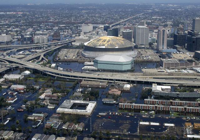
Sea level also varies over time. Tides run in 19-year cycles, thus the "mean" between high and low tides is going to vary during that cycle. In cases like New Orleans, where the elevation varies between 20 feet above sea level to nearly seven feet below sea level, whether a particular point on land is above or below sea level can depend on the given time within the tidal cycle.
Global climate also effects sea level. During the last Ice Age, worldwide sea levels were as much as 100 feet lower than they are today, when much of the planet's water was frozen into ice. Climate scientists say a warming climate has increase sea levels by as as much as a meter every 50 years.
New Orleans Is Below Sea Level. The United States Geological Survey puts the lowest point in Louisiana in the city of New Orleans at eight feet below sea level. Of the nation's 50 largest cities, 17 have areas at or below sea level. Of those, only Houston does not lie on a sea coast. Washington DC, with a minimum elevation of 1 foot, just misses making the list.
A city may have areas at sea level and not be in danger of flooding however. San Francisco and Seattle are both on the above list, for instance, but most of the inhabited areas of these cities lie well above sea level. As I write this, I am in Seattle a mile from the nearest beach, but 125 feet above sea level. Long Beach, California has spots as low as 7 feet below sea level, and as high as 360 feet above. On the other hand, a post-Katrina study by Tulane and Xavier Universities found that 51% of New Orleans was between sea level and 20 feet above.
New Orleans Is Above Sea Level. The Tulane and Xavier study pointed out that most of New Orleans's population lives in areas above sea level. The study also found that much of the area above sea level was under-utilized. This may be important, as New Orleans may be sinking. A report by the American Society of Civil Engineers found that the city my be sinking due to the natural settling of underlying soil, the pumping of groundwater and, ironically, the use of flooding control measures which prevent the natural replacing of silt and sediment by the Mississippi River.


No comments:
Post a Comment